
How many people use the Superior Hiking Trail each year?
May 30th, 2024

This is one of the most common questions we are asked at the Superior Hiking Trail Association, and one that is really tough to answer.
Our Trail is free to use, requires no permits, and is 300 miles long. Other factors come into play as well — access and proximity to population centers and locations made known by regional tourism marketing. But thanks to our Master Plan trail user count and user surveys in 2023, we now have a number: the SHT received 407,472 visits between May and November of last year.
That number — 407,472 — captures the total number of visits to the Trail last year, not the total number of trail users.
“The total number of different people who use the Trail is much smaller than the estimate of total user visits,” the Master Plan authors explain. Counting the individual number of people who use the Trail every year is much harder.
How did we count trail traffic?
The user counts technical committee included Dr. Greg Lindsey, University of Minnesota; Mackenzie Hogfeldt, Superior Hiking Trail Association (SHTA); Clayton Beck and Carson Polomis; and the Arrowhead Regional Development Commission (ARDC).
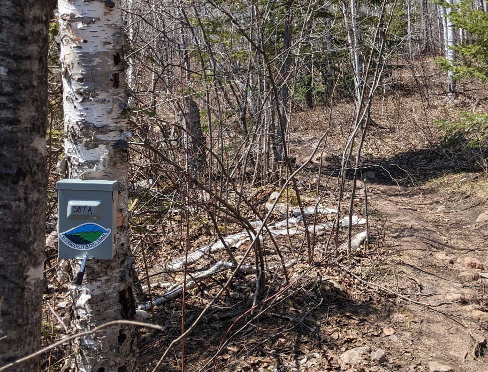
Using infrared sensor trail counters and a set rotation schedule, monitoring plan data was collected from 23 locations along the Trail. The data was then analyzed by the team. The total trail traffic counted was a whopping 708,647!
Using precedent methodologies by the Minnesota Department of Natural Resources to estimate visits to Minnesota bike trails, it is assumed that 85 percent of the trail users make out-and-back trips, while 15 percent complete a section or the entire Trail.
Multiple data sets help paint a more vivid picture of how the Trail is being used. User intercept surveys — surveys with trail users on the SHT — confirmed the trail user ratio based on responses from more than 340 people:

- Day hiking: 76.3%
- Trail running: 4.3%
- Overnight backpacking: 14.5%
- Thru-hiking: 0.6%
- Climbing: 1.4%
- Using the Trail for a different, unspecified purpose: 1.4%
User intercept surveys also showed how frequently people are using the Trail:
- Multiple times per year: 43.9%
- First-time visitor: 22.8%
- A few times per month: 16.5%
- A few times per week: 8.1%
- Once a year: 1.4%
- Daily: 1.2%
When we compare these percentages with our overall trail user count, about 25 percent of trail users are either first-time users or visit once a year, which means they account for about 100,000 of the 407,472 visits to the Trail last year.
The additional 307,472 visits are made by the other 75 percent of trail users who are visiting the SHT multiple times a year, month, or week.
The 400,000 visits are not spread equally across the Trail corridor. For example, the Duluth section of the Trail receives much higher usage levels than other segments of the SHT. Anecdotally, we hear from many Duluth volunteers and SHTA members that they use the Trail daily or multiple times a week.
The Trail also sees very high usage during the fall color season, particularly at popular overlooks, like the 17,000 visitors counted on the Bean and Bear Lakes Loop during the monitoring period. Traffic counts on the trail counter installed at the Reeves Road Trailhead near Two Harbors were much lower.
How will data be used?
Traffic by section data, coupled with asset inventory (information on the current condition of trail structures like boardwalk, bridges and signage) will help us set priorities for future trail renewal projects along the Trail. We also plan to use the data to help inform strategies to address visitor use management in partnership with our area land managers.
Trail Counts Will Continue.
During the summer of 2023, we monitored 23 different sections or 46 percent of the SHT. The SHTA intends to collect trail count data on additional sections in 2024, and the SHTA’s long-term objective is to monitor each of the 50 sections of the Trail. Thanks in part from the support from IRRRB (Iron Range Resources and Rehabilitation), we own 7 trail counters which will help us complete our goal.
Part of the larger plan.
These user count numbers are just one element of 14 months of data collection, public input, research, and analysis that have gone into our Master Planning process. We are drafting the final version of our Master Plan, which will be a comprehensive roadmap that outlines the vision, goals, and strategies for the development and preservation of the Superior Hiking Trail for the next decade.
The Plan will serve as a guiding document for trail management, sustainability initiatives, and future enhancements. We want to ensure the SHT remains a scenic and accessible wilderness experience while accommodating the increasing number of visitors to the Trail.
Thank you, funders!
This project was funded in part by the Coastal Zone Management Act of 1972, as amended, administered by the Office for Coastal Management, National Oceanic and Atmospheric Administration under Award NA22NOS4190054 provided to the Minnesota Department of Natural Resources for Minnesota’s Lake Superior Coastal Program.
This project was also funded by a Minnesota Department of Iron Range Resources and Rehabilitation Board Regional Trails Grant, made possible by taxes paid by Minnesota’s Mining Industry.
Support for our Master Plan also came from Superior Hiking Trail Association members and donors.