
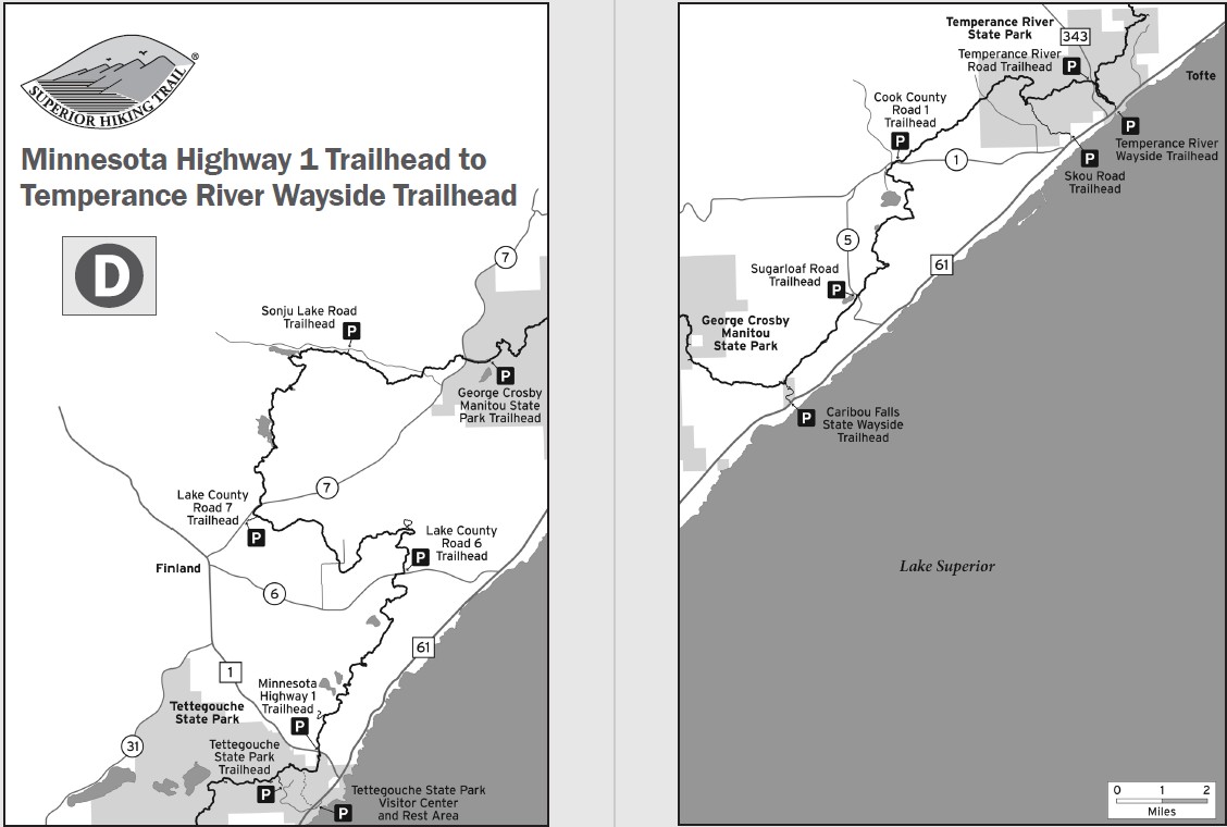
Sections South to North
 100vw, 1128px" />)
Highway 1 to Lake County Road 6
Length
6.8
Miles
Campsites
![]() 2
2
Directions
Highway 1 Trailhead: At Hwy. 61 milepost 59.3, turn left on Hwy. 1 and go 0.8 miles to trailhead parking lot on left. Overnight parking okay.
Description
- Some steep ascents and descents through maple forests
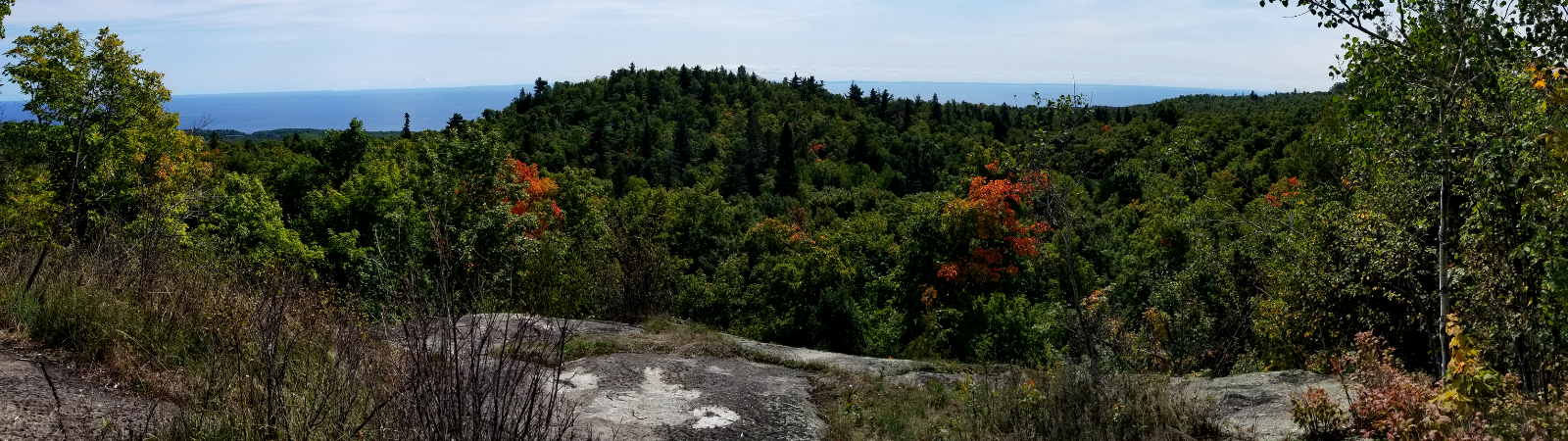
- Open ledges with great views of Lake Superior and inland lakes
- 0.5 mile spur trail to Fantasia Overlook

Lake County Road 6 to Lake County Road 7
Length
7.6
Miles
Campsites
![]() 2
2
Directions
Lake County Road 6 Trailhead: At Hwy. 61 milepost 65.3, turn left on Lake Co. Rd. 6 and go 2.3 miles to trailhead parking lot on right. Overnight parking okay.
Description
- Mileage includes 0.3 mile of access spur trail. Thru-hiker mileage for this section is 7.3 miles
- Climbs to Section 13 cliffs with breathtaking views from high cliffs overlooking Sawmill Creek and Baptism River Valleys
- Traverses 440-foot boardwalk over beaver dam
- Features huge glacial erratic rock over 20 feet tall
Lake County Road 7 to Crosby-Manitou State Park
Length
11.8
Miles
Campsites
![]() 7
7
Directions
Clair Nelson Community Center (Finland Rec Center) Trailhead: At Hwy. 61 milepost 59.3, turn left on Hwy. 1 and go 6.0 miles to Lake Co. Rd. 7 (Cramer Rd.). Turn right and go 1.3 miles to parking lot past the ball field at the Clair Nelson Community Center. Overnight parking okay, outhouse at trailhead.
Alternate Parking Option: Sonju Lake Road parking lot. At Hwy. 61 milepost 59.3, turn left on Hwy. 1 and go 6.0 miles to lake Co. Rd. 7 (Cramer Rd.). Turn right and go 6.8 miles. Turn left on Sonju Lake Rd. and go 2.3 miles to parking lot on left. Overnight parking okay.
Description
- Mileage includes 0.3 mile of access spur trail. Thru-hiker mileage for this section is 11.5 miles
- Features spectacular Egge and Sonju Lakes
- Boardwalk to Lily Island on Sonju Lake
- Travels through beautiful maple and cedar forests
Crosby-Manitou State Park to Caribou Falls State Wayside
Length
8.0
Miles
Campsites
![]() 2
2
Directions
Crosby-Manitou State Park Trailhead: At Hwy. 61 milepost 59.3, turn left on Hwy. 1 and go 6.0 miles to Lake Co. Rd. 7 (Cramer Rd.). Turn right and go 7.8 miles to entrance of Crosby-Manitou State Park. Turn right and go 0.9 miles to trailhead parking lot. State park sticker required; purchase annual sticker at another park. Single or several day use permit can be purchased via self-registration and payment onsite. Outhouse at trailhead.
Caribou Falls State Wayside Trailhead: At Hwy. 61 milepost 70.5 on left side of highway. No overnight parking.
Description
- Mileage includes 0.7 mile of access spur trail. Thru-hiker mileage for this section is 7.3 miles
- Rugged, challenging terrain with dramatic views of Lake Superior and inland ridges
- Bridges over stunning Manitou River and Caribou River
Caribou Falls State Wayside to Cook County Road 1
Length
9.0
Miles
Campsites
![]() 4
4
Directions
Caribou River Wayside Trailhead: At Hwy. 61 milepost 70.5 on left side of highway. No overnight parking.
Alternate Parking Option: At Hwy. 61 milepost 73.3 turn north on Sugarloaf Rd. and go 1.5 miles to parking lot on left. Overnight parking okay.
Description
- Mileage includes 0.7 mile of access spur trail. Thru-hiker mileage for this section is 8.3 miles
- Ascends dramatic Caribou River gorge
- Features Alfred’s Pond, Dyer’s Creek, and Two Island River
Cook County Road 1 to Temperance River State Park
Length
8
Miles
Campsites
![]() 5
5
Directions
Cook County Road 1 Trailhead: At Hwy. 61 milepost 78.8, turn left on Cook Co. Rd. 1 (Cramer Rd.) and go 3.6 miles to parking lot on right. Overnight parking okay.
Alternate Parking Option #1: Skou Road parking lot. At Hwy. 61 milepost 78.9, turn left and go 0.1 mile to small parking lot on right at 90-degree turn in road. A 1.5 mile spur trail goes to the main trail. Overnight parking okay.
Alternate Parking Option #2: Forest Rd. 343 (Temperance River Road) parking lot. At Hwy. 61 milepost 80.2, turn left (north) and go 0.9 miles to trailhead parking lot on left. Overnight parking okay.
Description
- Mileage includes 0.2 mile of access spur trail. Thru-hiker mileage for this section is 7.8 miles
- Follows the historic Cross and Temperance Rivers for several miles
- Rich old growth maple forest with views at Tower Overlook
- Crosses Fredenburg Creek and follows along Boney’s Meadow, an old beaver pond