
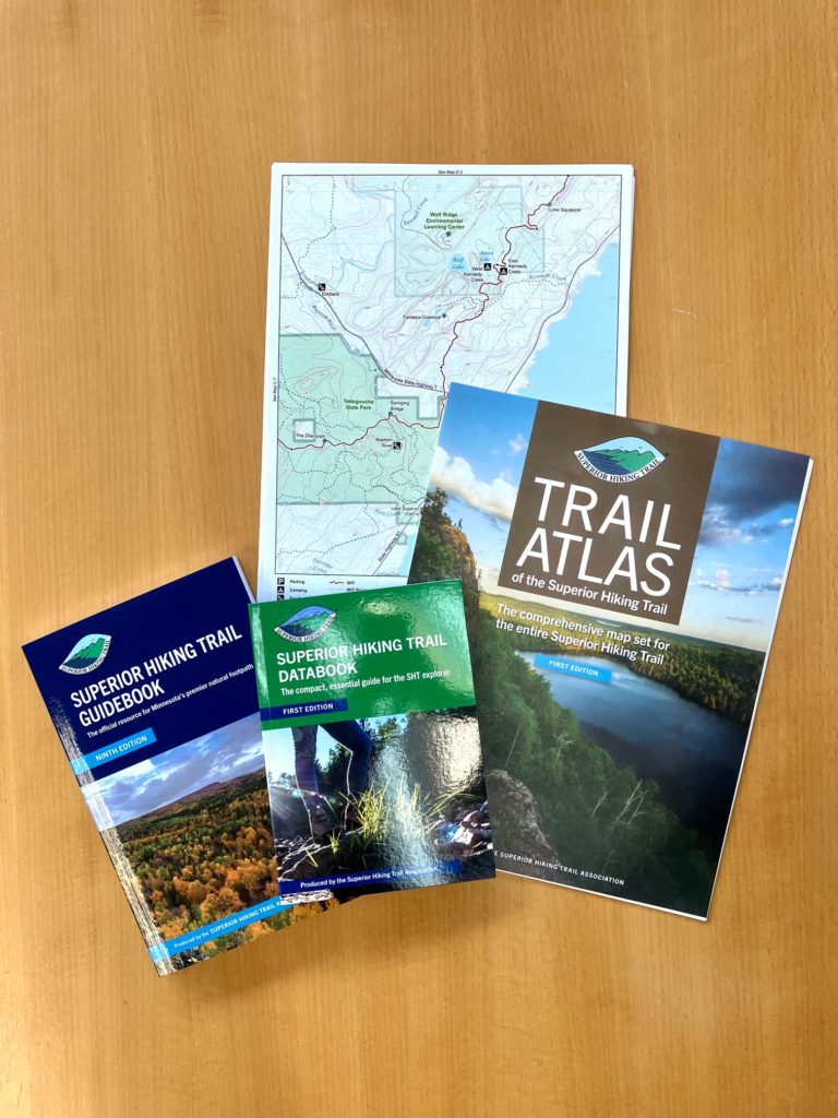
SHTA offers variety of guides and maps
July 28, 2022
By Mackenzie Hogfeldt, SHTA Trail Stewardship Director
The Superior Hiking Trail Association produces a range of guides and maps to help you plan anything from a day hike to a thru-hike, and keep you safe on the Trail. Our publications and maps also generate funding that helps us manage and maintain the Trail. It is truly incredible how much we do for the Trail with the proceeds from our publications.
During the past few years, we have intentionally expanded and changed our publications to better reflect how Trail users are using our publications and the Trail. With that perspective, we have created the:
- Superior Hiking Trail Guidebook (the primary guide for the Trail),
- Trail Atlas of The Superior Hiking Trail (maps for the entire Trail),
- Trail Atlas of The Superior Hiking Trail on Avenza (digital, GPS-enabled maps),
- Superior Hiking Trail Map Series A,B,C,D,E,F (Section maps of the Trail which are also available on Avenza), and
- Superior Hiking Trail Databook, (a condensed, quick guide).

There are many differences between our publications. To help hikers, backpackers and runners determine which best serves their needs, here is a description of each publication we produce, what features they include, and how they are most commonly used.
Superior Hiking Trail Guidebook (11.1 oz) 207 pages
Our guidebook has all the information that you need for trip planning at home, or to bring along in the car and pick day hikes on the fly. The guide includes detailed information on trail sections, notable features and vistas, campsites, water sources, trailheads and mileages. There are simple yet fairly detailed maps to accompany the descriptions of each section. Some people take it on longer trips because of all the information it provides, yet others use it primarily for planning their trip and leave it home on the coffee table and opt for lighter weight options while on Trail like our Trail Atlas and Databook.
Trail Atlas of The Superior Hiking Trail (6.1 oz) 21 pages
The Trail Atlas includes maps for the Trail’s entire length. Full-color, double-sided 8 ½” x 11” pages show the Trail’s route, the topography of the land, locations of campsites and Trailheads, water features, vista points and more. The maps also include other intersecting trails and roadway you might cross to help orient yourself or use other trails to go into town or walk to a private campground on our Duluth section, for example. The maps provide the perfect bird’s eye view of your adventure. Some people purchase the entire Trail Atlas and take only the section they are hiking that trip to save weight. It’s a very versatile format that allows you to only bring what is necessary.
The Trail Atlas of The Superior Hiking Trail on Avenza (0 oz)
Currently our lightest weight option, but don’t be fooled! It’s still the same Trail Atlas of The Superior Hiking Trail but in the Avenza App. This option is loaded with features to help you navigate, save favorite locations, track routes and even measure distances.
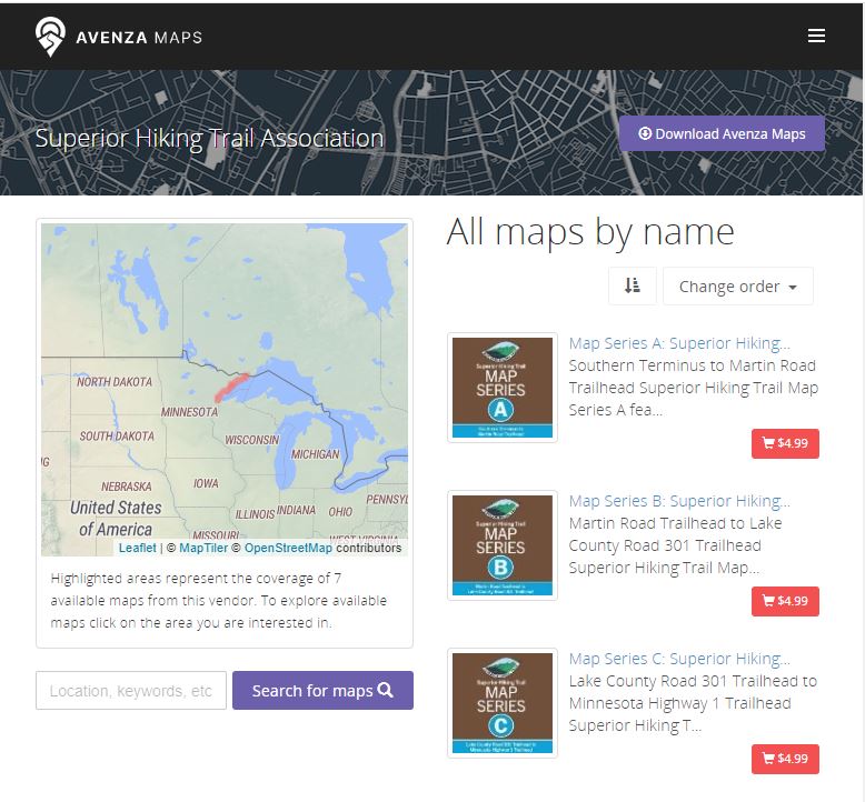
The app also uses your phone’s GPS to display exactly where you are so you will always know how far it is to that next overlook or campsite. Your phone’s GPS and our digital maps function even when you don’t have cell signal. A really nice feature of our digital maps is the orientation arrow that shows you what direction you are facing. The SHT is well-maintained and usually easy to follow, but if you were to find yourself off-trail or feeling a little lost, our digital maps are the best resource to help guide you back to the Trail or confirm you’re heading the right direction.
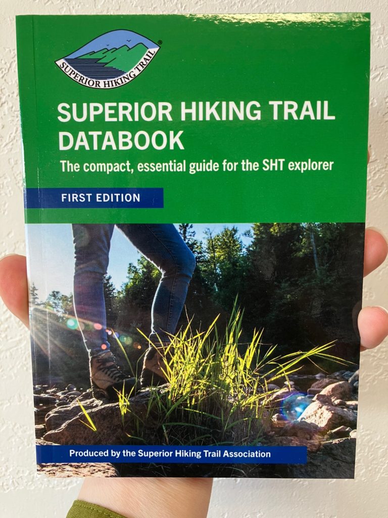
Superior Hiking Trail Databook (3.0 oz) 65 pages
The Databook is a fast and light option designed for the thru-hiker who wants a quick, light reference but is also a great option for trip planning, day hikes and runs, and section hikes. The Databook contains just the “data” of the trail like campsite and trailhead index, a list of distances between campsites, elevation change maps in 10-mile increments, and more. If the main guide is the textbook of the Trail, the Databook is like the CliffsNotes.
Superior Hiking Trail Map Series (1.5 oz)
The Map Series is the Trail Atlas of The Superior Hiking Trail broken up into 6 sections. The trail atlas is already divided this way with section labels at the bottom of each page, but in the series we separated them for your convenience. Taking your first hike on the SHT and not ready to invest in the entire Trail Atlas? This is a great option for you. This option was developed for people who concentrate their hikes to one section of the trail and is also paying homage to our old section maps that divided the trail into these sections.
SHTA guides and maps offer the most up-to-date, accurate Trail information
The internet is filled with free trail apps and websites, but the quality of their data can vary. When did they last update their maps of the Trail? Where are they getting their information? We receive frequent reports of free GPS apps not having the correct information, which can create real safety issues during a hike or run.

We encourage the use of our products over other publications because we are focused on producing the most up-to-date and accurate materials to keep trail users safe, educated, and oriented while exploring the trail. This differs from other materials, online mapping services and apps in particular, because we, the Superior Hiking Trail Association, are constantly collecting edits and tracking changes to the trail corridor.
We update our guidebook and databook every 2-3 years depending on the number of major route changes. Our maps are updated on a regular basis with an annual update to our Trail Atlas and biannual update to our digital Trail Atlas published through Avenza. We are also working on publishing digital, e-Book versions of our Superior Hiking Trail Databook and Superior Hiking Trail Guidebook so keep your eyes peeled for lighter, digital versions of our guides in the near future.