


Updated August 24, 2026

“Superior Hiking Trail 40th Anniversary Logo” by Kris Kiel.
This year the Superior Hiking Trail turns 40. We are celebrating by looking back at the events of the past forty years that brought us to today. The stories below trace the Trail’s journey from a bold idea to the current 300-mile footpath that winds along the rocky ridgeline of the North Shore. These reminiscences and retrospectives detail how the Trail is truly more than a path, it is a living link between people, place, and purpose.
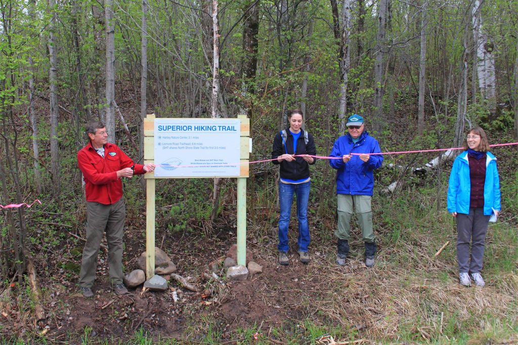
Ribbon cutting for the final two Superior Hiking Trail sections between Duluth and Two Harbors on National Trails Day, June 1, 2013. The completion of these last gaps created a continuous 296-mile Superior Hiking Trail corridor stretching from Jay Cooke State Park to just shy of the Canadian border. Photo by Gayle Coyer.
The years surrounding the Superior Hiking Trail’s 25th anniversary tested both the resilience of the footpath and the determination of the community behind it. In 2009, a destructive ice storm toppled trees across nearly 100 miles of Trail corridor, creating the worst storm damage the SHT had faced since construction began in the 1980s. Yet even amid cleanup efforts, construction between Duluth and Two Harbors pressed forward.
In 2011 and 2012 new sections opened between Martin Road, Lismore Road, and Normanna Road, steadily closing the final major gaps between Duluth and Two Harbors. Then came the devastating June 2012 flood. Record rainfall washed out bridges, destroyed boardwalks, and severely damaged sections of Trail. It highlighted the Trail’s vulnerabilities and made it clear that a new approach was needed to plan for future disasters, ensuring the Trail’s long-term resilience and sustainability.
The recovery effort reshaped the future of the SHT. Trail reroutes, improved drainage, and more sustainable construction practices became central to long-term stewardship. Still, there were many reasons to celebrate. In 2013, after six years of construction, the final Duluth-to-Two Harbors connection was completed, creating a continuous Trail corridor along Minnesota’s North Shore.
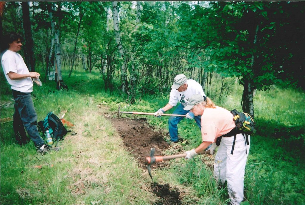
Volunteers construct new Superior Hiking Trail tread in Duluth in 2005 during the rapid expansion of the city sections. Duluth Trail Supervisor Judy Gibbs (left) helped lead the effort alongside hundreds of volunteers and Minnesota Conservation Corps crews who helped bring the SHT into the city. Photo by Bill Dryborough.
National Trails Day 2005 marked the opening of the first official Superior Hiking Trail segment in Duluth, from Skyline Parkway to Twin Ponds. Hikers quickly discovered that despite being within city limits, the new sections felt rugged, steep, and surprisingly wild. The Duluth route reflected both opportunity and compromise. While the Association had envisioned a more northerly ridgeline alignment through the city, land ownership and development required a different approach. Instead, the Trail connected to the Lakewalk and nearby business districts, creating an urban link while keeping the dream of a continuous ridgeline route alive for the future.
Construction accelerated quickly. By 2006, more than 20 miles of Trail stretched throughout Duluth, and by spring 2007 the 39-mile Duluth city section was complete. Attention quickly turned to extending the Trail toward the Wisconsin border and constructing roughly 50 miles of new Trail between Duluth and Two Harbors.
The Association celebrated its 20th anniversary during this era, volunteers and staff also recognized a new challenge: some of the Trail’s earliest sections were already requiring major rehabilitation and long-term stewardship planning. Still, the Duluth expansion introduced an entirely new audience to the Superior Hiking Trail.
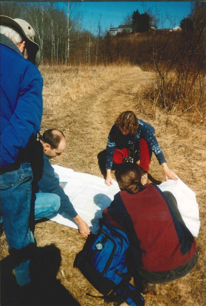
Volunteers review maps and scout potential trail routes in Duluth during early planning efforts for the Superior Hiking Trail expansion, Left to Right: John Green, Andy Holak, Gayle Coyer, and Diane DeSotelle, circa 2002–2003. Photo by Bill Dryborough.
The early 2000s marked a period of growing momentum for the Superior Hiking Trail Association. Membership surpassed 3,000, online trail resources and GPS expanded access to the SHT, and attention increasingly turned toward the long-discussed vision of extending the Trail into Duluth and toward the Wisconsin border.
From 2001 to 2003, staff, volunteers, and partners worked through route finding and planning for the Duluth expansion. That vision became tangible in 2004 when volunteers and Minnesota Conservation Corps crews constructed more than seven miles of new Trail in Duluth. More than 140 volunteers helped clear corridor, move rock, and shape tread through creek valleys and wooded hillsides overlooking the St. Louis River. It was one of the largest expansion efforts since the original construction years and carried the same grassroots spirit that launched the Trail in the 1980s.
At the same time, guided hikes, backpacking trips, and endurance races expanded the Trail’s visibility and strengthened the growing SHT community. The Trail was connecting communities across northeastern Minnesota.

In 1997, the Superior Hiking Trail Association marked ten years of trail construction with its Annual Meeting and 10th Anniversary Celebration, honoring the volunteers, members, partners, and supporters whose step-by-step efforts built both the Trail and its strong culture of community and stewardship.
Entering its “adolescent years” and celebrating its 10th anniversary, the Superior Hiking Trail Association shifted from building the Trail to caring for it. With more than 200 miles established, maintenance, stewardship, and long-term sustainability became the focus. Volunteers remained the heart and soul of the organization, continuing to power the Trail’s success by building bridges, clearing blowdowns, repairing tread, leading group hikes, and organizing on-Trail events.
Growing responsibilities made membership support more important than ever. Recruitment and outreach expanded to welcome new audiences and encourage Trail users to become members. Trailhead kiosks were installed, presentations and brochures were shared statewide, and the Association launched its first website. As use increased, Leave No Trace education gained prominence, reinforcing shared responsibility for protecting the Trail.
Even as funding constraints slowed development, the vision grew. In 1998, collaboration with the North Country National Scenic Trail led the Association to broaden its mission to “build and maintain a continuous hiking trail from the Minnesota–Wisconsin border to Canada”, marking a new era defined by stewardship and resilience.
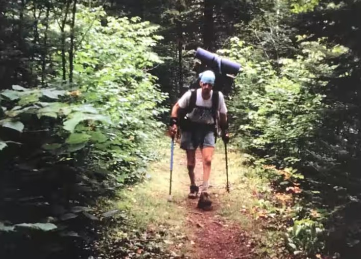
In 1995, Paul Hlina completed the first known thru-hike of the Superior Hiking Trail—from Two Harbors to the Canadian border—using arm crutches following a spinal cord injury. Hiking nearly 200 miles while raising funds for the Superior Hiking Trail Association and Wilderness Inquiry, his journey inspired others and helped establish the Trail as a true destination for long-distance hikers.
By 1993, word about the Superior Hiking Trail was spreading far beyond Minnesota’s North Shore. The first Guide to the Superior Hiking Trail transformed the footpath into a true destination, selling thousands of copies and introducing hikers nationwide to nearly 200 miles of ridgeline adventure. National recognition followed, including praise from Backpacker Magazine, signaling the SHT’s arrival among America’s premier long-distance hikes.
As construction funding ended, the Association shifted toward stewardship. Volunteers and members became the Trail’s backbone, supporting maintenance, fundraising, and growing programming. In 1994, the Trail received official designation as a National Recreation Trail, while guidebooks appeared in major bookstores and a public headquarters opened in Two Harbors.
The Trail’s legitimacy was cemented in 1995 when Paul Hlina completed the first known thru-hike demonstrating both the continuity of the Trail and its power to inspire. The secret was out: the Superior Hiking Trail had become a nationally recognized destination.
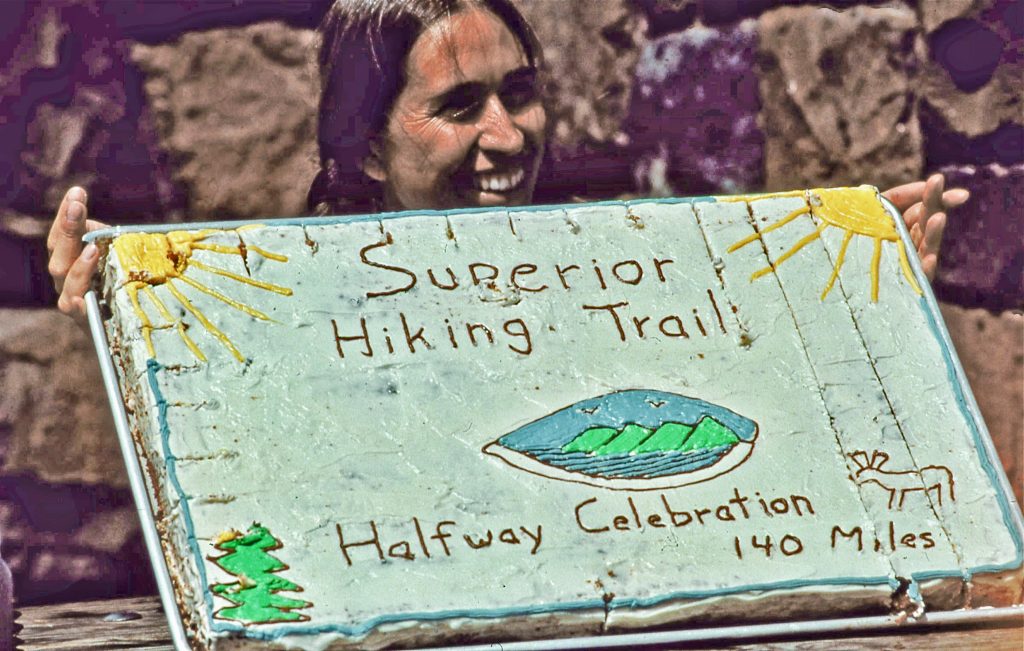
Cindy Johnson Groh holds the Superior Hiking Trail Halfway celebration cake, honoring the 16 hikers who completed some or all of the 140-mile journey from Grand Marais to Gooseberry Falls in 12 days. Photo courtesy of Rudi Hargesheimer.
By 1990, the SHTA was nearly halfway to linking Duluth with the Canadian border, though the hardest miles still lay ahead. The Trail expanded from the center outward—northeast and southwest—despite reduced funding and stubborn easements. Sixteen hikers marked the Halfway Hike by trekking some or all of the 140 miles from Grand Marais to Gooseberry Falls. Materials were flown in by helicopter to install the first major bridge over the Baptism River. A new shuttle service launched, Highway 61 gained SHT signage, and membership continued to grow.
In 1991, the organization entered a new phase. Tricia Ryan became the first paid staff member, signaling a shift toward a more structured nonprofit. More than 100 supporters gathered at Wolf Ridge Environmental Learning Center for the Annual Meeting. The inaugural Superior 100 ultramarathon drew national attention, while lodge-to-lodge hikes and growing winter use reflected a trail coming into its own.
By 1993, crews raced to finish priority segments before LCMR funding expired, relying increasingly on member support to sustain momentum and maintain progress. What began as an ambitious idea was steadily hardening into reality—mile by mile, bridge by bridge, and with every volunteer hour, the Superior Hiking Trail was claiming its place along the North Shore.

1987 Opening ceremony log-cutting at Britton Peak in Tofte. Left to right: Steve Thorne, Deputy Commissioner of MN DNR; Marlene Johnson, MN Lieutenant Governor; James Oberstar, MN 8th District US Congressman; Blaine Fenstad and Beth Blank, Resort owners. From the second SHTA Ridgeline Newsletter, July/August 1987.
On July 1, 1987, a $390,000 grant from the Legislative Commission on Minnesota Resources launched major construction of the Trail, aiming to build 80–90 miles in two years. The funding covered construction, but not long-term maintenance, making active membership essential from the start. Volunteers poured in with such enthusiasm that organizing them often lagged behind their energy.
Just days later, on July 5, supporters and state representatives gathered at Britton Peak for a ceremonial log cutting, complete with trail songs, celebrating the first steps toward a ridgeline trail above Lake Superior.
Trail Coordinator Tom Peterson flagged routes with topo map, compass, and pencil, while crews from the Minnesota Conservation Corps, Youth Conservation Corps, and laid-off Silver Bay miners built tread by hand. By 1989, 100 miles were complete, signs began to mark the way, hikers from around the Nation arrived, and membership grew—proof that vision and many boots on the ground could create a lasting trail.
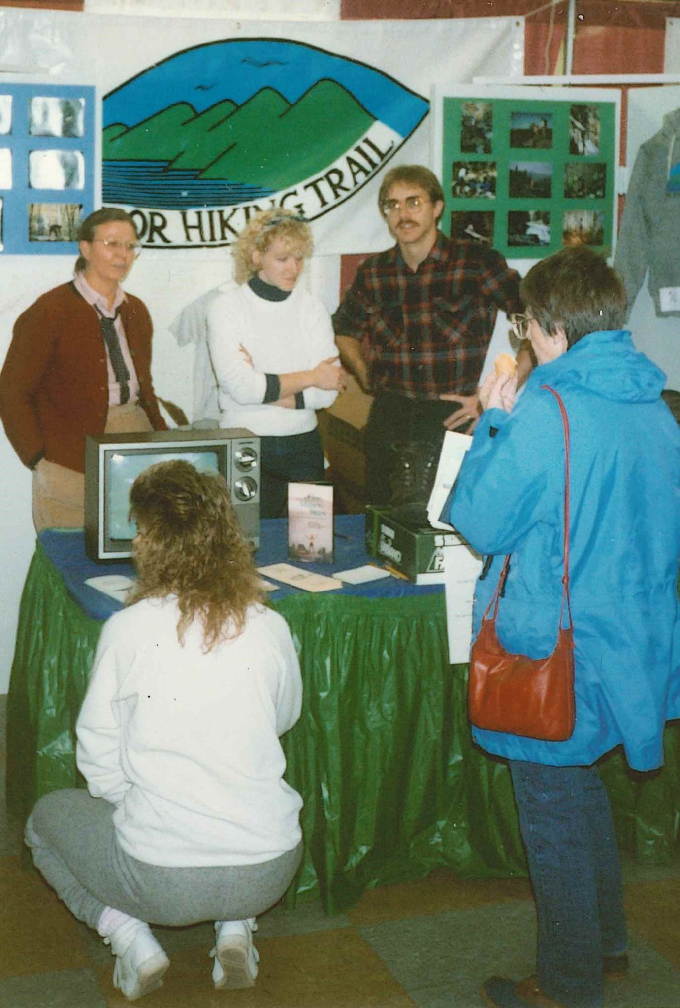
Volunteers promote the Superior Hiking Trail at Winterfest in 1988.
In 1986, Leland (Lee) Scharr, Superior National Forest Tofte District Ranger, prepared a student project to fulfill the professional development requirement for the Outdoor Recreation Management program at Clemson University. This project would study the demand for a hiking trail, determine capacity of northeastern Minnesota to provide access, identify use projections, estimate the cost of construction, and gauge local interest and support for the project. This document became the guiding framework for what we now know as the Superior Hiking Trail.
At the time Lee was writing his paper, the concept of a long distance hiking trail along the North Shore was already developed and parts were even being built. The trail was included in the 1979 Statewide Comprehensive Outdoor Recreation Plan (SCORP) as well as a 1973 Forest Service trail plan for the Tofte Ranger District. Like many great ideas, there is no one originator for the Trail. It was a collective development by many thought partners. However, Scharr’s feasibility study gave teeth to these concepts and built agency amongst local land managers, resort and business owners, and community members.
In a July 2012 letter from Lee, he reflects on on the beginning of the Superior Hiking Trail Association, “In January 1986 (the day the Challenger space shuttle exploded) we had our first meeting with local resorters and interested people to see if there was support needed to go after funding based on the demand data I found for the feasibility study.”
With a strong partnership and shared vision between the Superior National Forest and the Minnesota DNR, alongside the communities and business owners of the North Shore, the Superior Hiking Trail Association was created.